What You Authorized Was Never the Use, It Was the Data: Pokémon Go Scans Flow Into Military Drones
Street footage that hundreds of millions of players captured for game rewards trained a vision navigation model now headed into military drones. Consent for a game is not consent for a weapons program.
Summary
Hundreds of millions of Pokémon Go players spent years filming the streets, parks, and buildings around them for in-game rewards. Those roughly 30 billion environmental scans are now owned by Niantic Spatial, and they trained a camera-based navigation model that a U.S. defense contractor is preparing to put into drones and military robots. Most players had no idea.
The part that stings is not the technology but the source of the training data, and an unavoidable question: would the people who supplied it have agreed had anyone explained the destination? Our read is that when you tap “accept,” what you authorize is never a specific use, it is the data itself, and the use of data drifts. A license signed to catch Pikachu got sold up a chain that ends at a Saudi sovereign wealth fund and a defense prime. Consent obtained for a game is not consent for a weapons program, even if the end use turns out to be defensible.
What happened
The pipeline runs from a phone game to the battlefield in three steps. First, players scanned the physical world. Since 2021, Pokémon Go has asked players to record short videos of real locations, called Pokéstops, to earn extra items. The 360-degree sweep of nearby buildings, streets, and trees was optional, and Niantic asked separately for permission to keep the footage, with granting it meaning you accepted extra terms. Those terms handed Niantic a transferable, sublicensable license to the scans, meaning the company could resell the imagery to third parties.
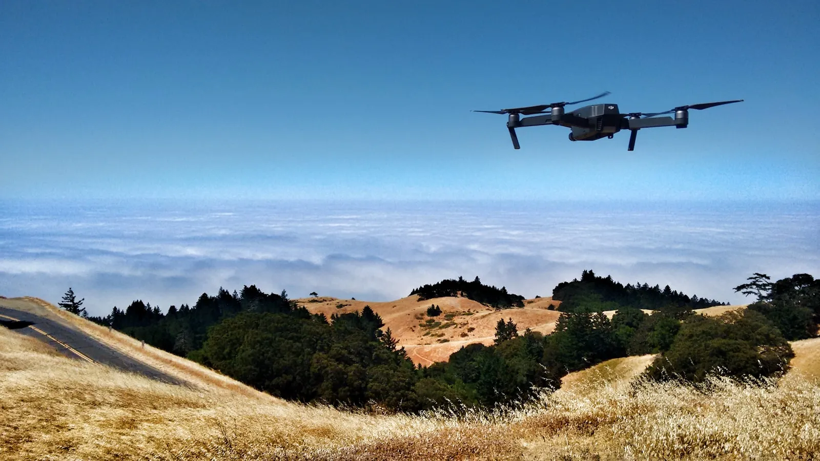
Second, Niantic Spatial turned the scans into a 3D map that lets a machine locate itself by sight when satellite signals fail. The roughly 30 billion scans (the figure comes from Trouw) became raw material for a Visual Positioning System (VPS). Where GPS depends on a satellite signal, VPS works out where a camera is by matching what it sees against a detailed 3D model of the world, and two recognizable reference points a few pixels wide can be enough to fix a location. Niantic Spatial CTO Brian McClendon, who previously led the teams behind Google Maps, Google Earth, and Street View, has said the approach suits robots operating where GPS regularly drops out, such as dense cities, and where signals are deliberately blocked, such as war zones.
Third, on December 16, 2025, Niantic Spatial announced a partnership with Vantor. Vantor, formerly Maxar Intelligence and rebranded on October 1, 2025, is a prime contractor to the National Geospatial-Intelligence Agency, holding a $70 million follow-on award under the agency’s Global Enhanced GEOINT Delivery program, which serves more than 400,000 U.S. government users. The partnership fuses two positioning systems into one. Niantic Spatial handles localization on the ground by aligning a camera feed against its model. Vantor’s Raptor software, launched in February 2025, does the same job in the air using a drone’s camera and Vantor’s proprietary 3D terrain data. Combined, the companies say, a drone overhead and a vehicle or dismounted operator below can share the same coordinates in real time with no satellite link. Field testing of the integrated system is planned for early 2026.
One detail worth recording: the principle is already showing up on the other side of the front. A downed Russian drone was found matching live camera feeds against preloaded terrain imagery rather than trusting a single GPS module. Visual positioning solves a real problem.
Why it matters
To see this clearly, start by granting that the capability gap it closes is real. The moment an electronic warfare unit switches on a jammer, drones lose their way, and that is one of the most important gaps in the industry. Ukraine’s FirePoint built seven generations of navigation systems in roughly three years, landing on a terrain-matching setup that uses a cheap night camera to fly without GPS. Russia can jam GPS; it cannot jam a drone that does not need it. So the problem is not GPS-denied navigation itself, which is not sinister.
The discomfort is narrower and sharper. The training data came from people who thought they were catching Pikachu, under a license most never read, sold up a chain that ends at a sovereign wealth fund and a defense prime. In 2025 Niantic’s structure split again: the games business sold to Scopely for $3.5 billion, in a deal that closed in late May, and Scopely is owned by Saudi Arabia’s Savvy Games Group and ultimately the kingdom’s Public Investment Fund. The technology platform spun off as the standalone Niantic Spatial under John Hanke. The games went to a Saudi sovereign wealth fund. The map went to defense.
This drift is not an accident. Trace the company’s lineage and the military turn looks less like a swerve than a homecoming. Niantic grew out of Keyhole, a geographic data firm that took funding in 2003 from In-Q-Tel, the venture arm financed by the CIA. An In-Q-Tel release from that year stated Keyhole’s services supported U.S. troops during the Iraq War. Google bought Keyhole the following year, and Keyhole CEO John Hanke went on to lead Google Maps, Earth, and Street View, formed Niantic Labs inside Google in 2010, and spun it out in 2015. Niantic had collected camera imagery from players once before, through its 2014 game Ingress, using the same method later applied in Pokémon Go.
On the core dispute, TU Delft ethics and technology professor Jeroen van den Hoven gave the sharpest line: “Without the huge number of scans from all those gamers, the development of this system would never have progressed so quickly.” He did not condemn battlefield VPS outright. If it helps Ukraine win a just war against an aggressor, he said, that is a good development. His worry is the system falling into the wrong hands, and the broader pattern of players being misled about where their data goes. He called the episode a red flag.
Builder impact
If you build any product that captures user environment data (AR, spatial computing, robotics, mapping, delivery), this should change your design assumptions about consent. What a user can imagine at the moment of the checkbox is only the use in front of them; they cannot foresee an application five years out that they would fundamentally disagree with. Iris Muis, a data-ethics expert at Utrecht University’s Data School, put the trap plainly: a user cannot picture how their data might be used later. A broad, transferable, sublicensable license buried in the terms may hold up legally, but it hollows consent into a blank check.
The more concrete engineering point: once data is in the model, the governance window closes. Van den Hoven’s observation holds for any team training models on real user data. The original individual contributions blur into untraceable patterns, so a promise like “delete my data” becomes nearly impossible to honor at the model level. If you want to give users real control, the control point has to move forward to capture and licensing, not rest on the hope of later pulling someone’s data back out of a model, which is not technically feasible. That means a broad resale clause is not a legal detail to settle later; it is a product decision to tighten today.
For founders there is one more layer: the eventual owner of your data can change completely when the company changes hands. Niantic’s games and map were split in opposite directions in 2025, and the “game company” players faced years ago is now a Saudi fund and a defense contractor. Who owns the data you collect today, and what they do with it in five years, depends on a chain of acquisitions you do not control. Write that into the promise you make to users rather than dodge it.
What to ignore
Ignore the pulpy reading that “evil defense industry stole game data.” GPS-denied navigation is one of the most real capability gaps in the industry, the reason Shield AI’s V-BAT keeps flying when radio links die, and the reason the Pentagon’s Drone Dominance evaluations are adding GPS denial to Phase II this year. Visual positioning carries no original sin, and reading it all as conspiracy makes you miss the actual problem.
Do not let Vantor’s denial settle you either. It says it will not use Pokémon Go data, yet refuses to say whether the model it plans to deploy was already trained on those scans in the past. Those are not the same statement, and the difference is the whole story. Niantic Spatial, responding to a separate deal, said the scans were used to train an “early version” of its navigation model; on the defense partnership specifically, the company said it had no new information to share. Once scans are baked into a model, tracing them back is close to impossible, which conveniently makes the denial unfalsifiable. The non-answer is what to watch, not the denial.
Finally, do not treat the early-2026 field tests as the verdict on this. They will only tell you whether the air-to-ground system is real or a press release. They will not tell you whose footage is inside the model, and so far nobody at either company will say.
FAQ
Is Vantor's denial of using Pokémon Go data credible?
It is neither credible nor falsifiable. Vantor told Trouw it would not use the game's data, but declined to say whether the model it plans to deploy was already trained on those scans in the past. Those are two different statements. TU Delft ethics professor van den Hoven notes that once scans are baked into a model they blur into patterns in the weights, making them nearly impossible to trace, which conveniently leaves the denial unfalsifiable.
Once data is trained into an AI model, can it still be traced back to one person's scan?
Essentially no. Van den Hoven says an AI model starts from a dataset, then absorbs far more data, and the original individual contributions blur into untraceable patterns. That means you can prove neither that your scan is in the model nor that it is not. This loss of traceability is the hardest part of governing this kind of data drift.
Should I stop scanning in Pokémon Go?
If you care where your data goes, yes. British game designer Adrian Hon has advised players to stop making scans and consider smaller games less likely to resell data. The issue is not any single scan but the transferable, sublicensable license: it lets Niantic sell the imagery to third parties whose uses you cannot foresee.
Is this only a Pokémon Go problem?
No. Meta's smart glasses continuously scan your surroundings, Apple's AR hardware builds 3D models of interiors, and Waymo's self-driving cars reconstruct street layouts. Niantic Spatial also announced a March 2025 deal with Coco Robotics to guide delivery robots already rolling through U.S. cities and Helsinki. The camera in your pocket feeding a map is not the only one.
Sources
No official primary source available; this analysis is based on reliable secondary reporting (named outlets, cross-confirmed).